St Saviour's (St Francis Xavier's)
Burnie, Tasmania
Originally known as St. Francis Xavier's, this church came to be frequently referred to as St. Saviour's. It was later changed its name to St Mary's-Star-of-the-Sea. In 1855, Bishop Willson...
- Denomination
- Catholic
- Region
- North West
- Year Built
- 1856
- Architectural Style
- Church
- Heritage Status
- Heritage listed
Overview
Originally known as St. Francis Xavier's, this church came to be frequently referred to as St. Saviour's. It was later changed its name to St Mary's-Star-of-the-Sea.
In 1855, Bishop Willson was given four adjoining quarter-acre blocks of land by the Van Diemen's Land Company. This land, intended for the construction of a church. It was situated at the corner of Cattley and Wilson Streets. In 1856 a small timber church was built on this land.
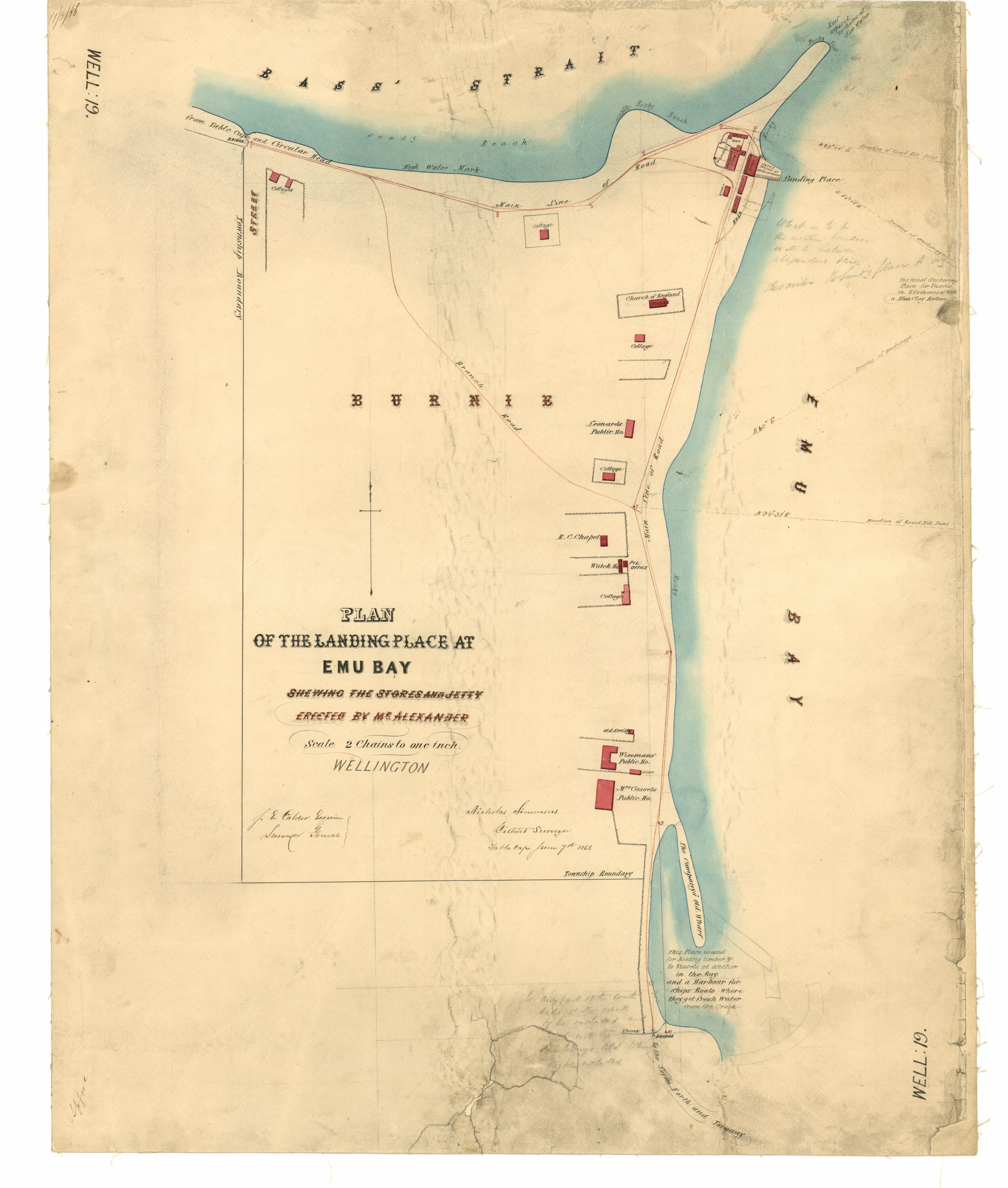
The precise location of this Roman Catholic Chapel is documented in an 1866 map by Surveyor Nicholas Simmons, produced under the authority of the Lands and Surveys Department.
This church was later replaced.
See also No 1148
History
1855
land given for church construction
1856
small timber church built
built
Gallery
References
- Kerry Pink, Campsite to City : a history of Burnie, 1827-2000, Burnie, Tas, 2000, p. 248Tasmanian Pictorial Church Index
- The Advocate Weekend Magazine - Burnie History Up for SaleTasmanian Pictorial Church Index
- W T Southerwood, Planting a Faith in Tasmania : The Country Parishes, W.T. Southerwood, Hobart 1977, p. 203Tasmanian Pictorial Church Index
Links
- EMU BAY. (1878, June 22). The Tasmanian (Launceston, Tas.: 1871 - 1879), p. 1
Tasmanian Pictorial Church Index
- Stella Maris School History website
Tasmanian Pictorial Church Index
- Wellington 19 - plan of the landing, surveyor Nicholas Simmons, AF396/1/1184, Tasmanian Archives place at Emu Bay
Tasmanian Pictorial Church Index
Services
Replaced by new build
Open
Not recorded
Address
Cattley Street, cnr Wilson Street, Burnie TAS 7320
Contact
Not recorded
Accessibility
Not recorded